Posts

HURRICANE MARIA DAMAGES COASTLINE

Hurricane Maria was a category 4, when the effects were first felt in St. Kitts and Nevis then increased to a category 5 from Monday 18-Tuesday 19 September 2017. The extensive damage caused by the storm surges has plagued parts of the islands’ coastline.  Articles such as http://dmrskn.com/what-to-expect-with-hurricane-maria/ gave insight regarding what to expect.

See below for pictures released from the Department of Marine Resources of the coastline showing locations from the South East Peninsula and Frigate Bay to Basseterre then from Old Road towards New Guinea,  Sandy Point then around to Dieppe Bay.

What to expect with Hurricane Maria?

As we prepare for Hurricane Maria, what effects should we expect from this natural phenomenon?

As indicated in this post http://dmrskn.com/impact-of-hurricane-irma-on-fish-landing-sites/ Hurricane Irma damaged fish landing sites in St. Kitts and Nevis. These damages were experienced even as Hurricane Irma passed to the north of the island. Most of the fish landing sites are located on the western side of the islands and are washed by the Caribbean Sea.  Hurricane Maria’s path indicates that she would pass south of St.Kitts and Nevis.

It is expected that the brunt of the impact from this hurricane will be felt on our coastline. St. Kitts and Nevis can experience storm surges caused from Hurricane Maria’s high speed winds. Storm surges can be caused by high speed winds create large waves, which when reaching the coast, they no longer have the deep ocean to continue the wave cycle hence pushing the waves unto land. They will produce waves that can inundate the coastline of St.Kitts and Nevis.

Strong gusts of wind combined with heavy rainfall can also impact infrastructure along the coastline.

Fishers and boat owners are advised to dry dock their vessels preferably further inland to avoid or minimize possible damages to their property.

We will keep you updated on the effects of Hurricane Maria after the storm has passed.

Satellite view of Hurricane Maria

Projected path of Hurricane Maria

,

Creative Murals promote Awareness

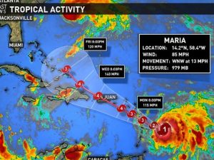
The Department of Marine Resources has embarked on a number of projects to raise the level of awareness for Kittitians and Nevisians of marine life and the importance of the sustainable use of marine resources for 2016.  The marine inspired dumpster project is one of the marquee projects that is expected to visually stimulate the populace.

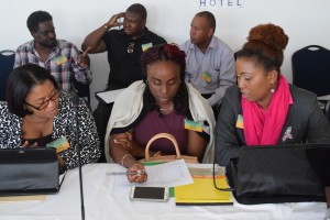
The Department commissioned Nevisian artist Mr Vaughn Anslyn to conceptualize and execute the project.  The results are as follows:


Before: Outline for the mural

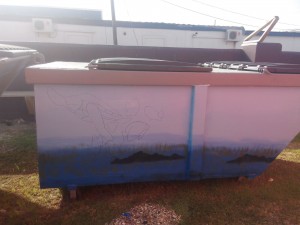
Before: Image Outline

Nevisian artist Vaughn Anslyn working on his masterpiece

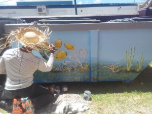
Nevisian artist Vaughn Anslyn working on the masterpiece.


Finished Visual on the dumpsters

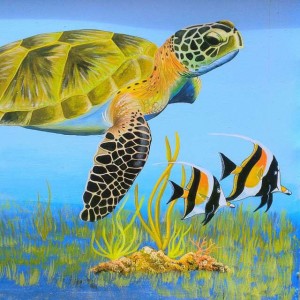
Finished visual on one of the dumpsters


Murals

This is who we are

Marine Life Dumpster in Day time


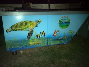
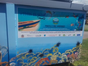
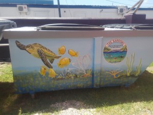
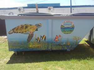
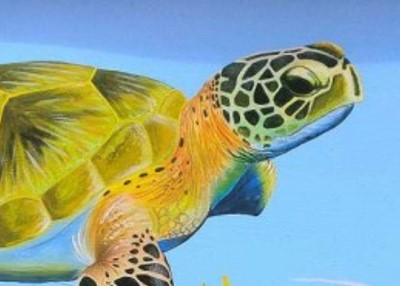
The murals feature various types of marine life that can be found in the proposed Narrows Marine Management Area including; Hawksbill Sea turtle, Angel fish, sea grass bed, corals, sea sponges and a sea fan.  The mural project was funded by CamPAM Small Grants with the Department of Marine Resources as the National Implementing Entity (NIE).  CamPAM seeks to support to the management of marine space within the region. Establishing Marine Management Areas (MMA) or Marine Protected Areas (MPA) is used as a regional tool to improve marine management, conserve marine biodiversity, address over fishing impacts, decrease user conflicts, and provide economic alternatives to local coastal communities. This has resulted in substantial knowledge gained on optimal site selection and design, successful outreach approaches, effective management strategies, and appropriate methods to evaluate their effectiveness.  The Department of Marine Resources is presently embarking on establishing a two-mile radius St.Kitts and Nevis MMA .

The marine-inspired dumpsters will be placed at various fish landing sites throughout St. Kitts and Nevis.

MMA Officer participates in OECS ICZM Consultation

OECS Consultation

Marine Management Areas and Habitat Monitoring Officer, Ms Tricia Greaux attended a two-day OECS Regional Consultation on: ” The Draft Model Integrated Coastal Zone Management (ICZM) Policy and Model Development Setback Guidelines”.  The USAID sponsored consultation took place February 11-12 th, 2016 at the Trade Wines Hotel, St. John’s Antigua.

The participants received training and engaged in active discussions on several critical issues over the duration of the workshop.  Some of which included: ” Concepts and Principles in ICZM”, “Decision Support Tools”,  ” Model OECS ICZM Policy” and “Model Coastal Development Setback Guidelines”.


,

History and Heritage Hike to the Narrows

On Saturday February 27th, 2016, The Deparment of Marine Resources partnered with the organisers of History and Heritage Month in St. Kitts and Nevis to guide a hike to Cockleshell Bay.

About 30 persons took part in the hike that was lead by Mr Kharim Saddler (Fisheries Assistant) with responsiblity for FAD’s and Seamoss Product Development.  Mr Saddler sensitized the participants about the benefits of the mangroves, biodiversity, the sand erosion on the South Friars Bay and the importance of protecting The Narrows (The Channel between St. Kitts and Nevis).

The hike began on Frigate Bay Lawn at about 6.30am and continued 6 miles to Cockleshell Bay.